



Survey & Mapping Services
Rent Our Surveying Expertise
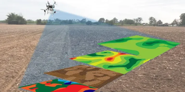
Get professional 3D maps, orthomosaic imagery, and volumetric measurements without buying expensive equipment. 24-48 hour turnaround.
₹8,000-15,000 per survey | GIS-ready data | ±2cm accuracy
The Simple Model: Pay • Use • Benefit
Pay
Per survey. No drone purchase needed, no maintenance costs.
Use
Our expertise & technology. 24-48 hour delivery included.
Benefit
Accurate data, ±2cm precision, GIS-ready reports instantly.
Why Choose Our Service
Fast Turnaround
Comprehensive survey completed in 24-48 hours.
High Accuracy
±2cm horizontal accuracy for precise measurements.
Complete Data
Orthomosaic, 3D models, & volumetric analysis included.
GIS-Ready Files
Compatible with all standard mapping & CAD software.
Professional Report
Detailed documentation with technical analysis included.
Quality Assured
DGCA-certified pilots ensure consistent quality.
What You Receive
Orthomosaic Imagery
High-resolution composite image of entire surveyed area for precise reference mapping.
3D Point Cloud
Millions of georeferenced points creating accurate 3D terrain model for analysis.
Digital Elevation Model
Precise elevation data for terrain analysis & volume calculations.
Volume Reports
Exact measurements for stockpiles, excavations, & land changes.
CAD-Compatible Files
DXF, GeoTIFF, & other formats ready for design software.
Technical Report
Complete documentation with methodology & analysis included.
Simple Pricing
Single Survey
✓ Up to 500 acres coverage
✓ All deliverables included
✓ 24-48 hour delivery
✓ One revision round
Price varies by area & complexity
Monthly Contract
✓ Unlimited surveys
✓ Priority scheduling
✓ 15-20% savings
✓ Dedicated support
Best for construction & monitoring projects
How It Works
Day 1
Site assessment & flight planning. Weather & safety check.
Day 1-2
Survey flight conducted. Data captured & initial processing begins.
Day 2-3
Complete analysis. Report & all files delivered to your email.
Request Your Survey Today
Professional aerial data without capital investment. Simple & fast process.