




FIRE & EMERGENCY RESPONSE
Real-Time Situational Awareness
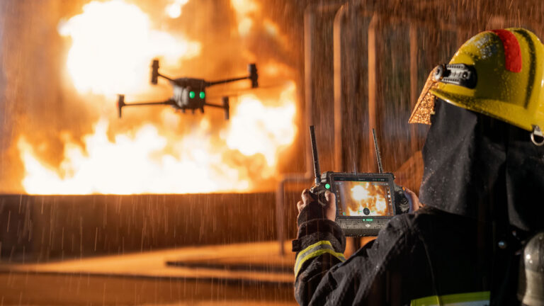
Thermal imaging & live video feed within minutes. Faster decision-making. Better tactical response. Lives saved.
Available 24/7 • DGCA Certified • Government Ready
Why Drone First Response?
5-Min Deployment
Faster than ground teams. Instant aerial assessment from command center
Thermal Detection
Identify fire hotspots & hidden flames invisible to naked eye
Zero Human Risk
No firefighters in danger zones. Safe reconnaissance before entry
Live Command Link
Real-time video to incident commander for tactical decisions
Our Vision for Bihar
🏙️ Urban Fire Response
Quick assessment of multi-story building fires. Rapid identification of fire spread, trapped persons, and structural hazards.
- Building hot-zone mapping
- Evacuation route planning
- Structural integrity check
- Tactical support for crews
⚙️ Industrial Safety
Factory, plant & warehouse fire management. Monitor hazmat areas without personnel exposure.
- Large facility rapid scan
- Hazmat zone identification
- Equipment failure detection
- Damage assessment post-incident
🌲 Forest Fire Monitoring
Early detection & spread tracking for forest fires. Real-time coordination with ground teams and responders.
- Fire boundary mapping
- Smoke drift tracking
- Access road assessment
- Resource deployment guidance
🚨 Disaster Response
Multi-hazard disasters: earthquakes, floods, cyclones. Rapid damage assessment & rescue coordination.
- Affected area mapping
- Damage severity assessment
- Stranded person location
- Resource allocation planning
Drone Specifications
🎥 Thermal Imaging
Range: -20°C to +600°C
Resolution: 320×256 pixel thermal array
Sensitivity: Detect flames from distance
Night Vision: Full operation in darkness
📡 Communication
Video Feed: Live 4K streaming
Range: 2-3km line of sight
Latency: <500ms delay
Encryption: Secure military-grade link
⚡ Flight Performance
Flight Time: 25-30 minutes
Speed: 60-80 km/h cruise
Wind Rating: 35+ km/h capability
Payload: 2-3kg camera systems
Emergency Response Timeline
Call In
Emergency Alert
Fire dept receives emergency call
1-2 min
Activation
Drone team alerted & mobilizes
3-5 min
Deployment
Drone airborne, streaming video
Continuous
Support
Real-time tactical intelligence
Operational Capabilities
Thermal Capabilities
✓ Temperature range detection (-20°C to +600°C)
✓ Fire hotspot identification in seconds
✓ Hidden flame detection through smoke
✓ Structural heat signature analysis
✓ Post-fire hotspot verification
Operational Features
✓ 24/7 availability (on-call ready)
✓ Multiple simultaneous missions
✓ Backup drone in rotation
✓ Weather-adaptive operations
✓ Government agency integration
Key Benefits
🚑 Lives Saved
Faster scene assessment = better tactical decisions = fewer casualties
👨🚒 Crew Safety
Drone reconnaissance reduces firefighter exposure to danger zones
💰 Cost Reduction
No helicopter deployment. Lower operational costs vs traditional methods
🎯 Accuracy
Precise fire mapping vs. guesswork. Better resource allocation
📊 Documentation
Permanent video record for investigation, insurance & learning
⚙️ Integration Ready
Works seamlessly with existing fire dept command systems
Protect Your Community
Deploy drone-based first response for faster, safer emergency operations