




Digital Map Your World
What We Deliver
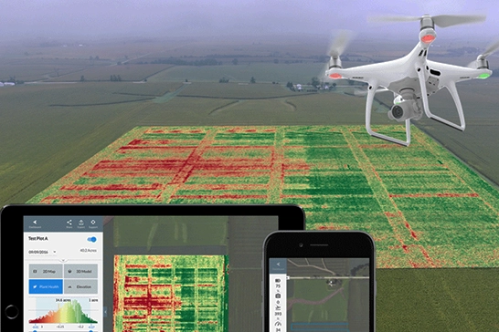
✓ Orthomosaic Maps
Precise, geo-referenced aerial images of your area for accurate planning and documentation.
✓ Land Use Classification
Detailed analysis of land use patterns, vegetation density, and terrain characteristics.
✓ GIS Layers
Multi-layered mapping data compatible with ArcGIS, QGIS and other GIS software.
✓ Change Detection
Monitor changes over time through periodic mapping and historical analysis.
Our Process
4-Step Mapping Workflow
1. Site Assessment
Initial reconnaissance, boundary marking & flight planning based on project requirements
2. Aerial Survey
High-altitude drone flight with precision GPS tracking & multiple image captures
3. Data Processing
Image stitching, georeferencing, radiometric correction & quality assurance checks
4. Delivery & Support
Final maps, comprehensive reports & GIS-ready data files with technical documentation
Common Applications
Urban Planning
City expansion & infrastructure planning with accurate baseline maps
Agricultural Analysis
Crop mapping, soil classification & productivity zone identification
Resource Management
Forest cover, water bodies & natural resource inventory mapping
Disaster Planning
Risk zone mapping for floods, landslides & emergency response
Environmental Monitoring
Vegetation health, land degradation & climate impact tracking
Development Projects
Site mapping for infrastructure, mining & industrial projects
Technical Specifications
Mapping Precision
Accuracy: ±2cm GSD (ground sample distance)
Resolution: 1cm-5cm depending on altitude
Coverage: 500+ acres per flight
Delivery: GeoTIFF, Shapefile, KML formats
Turnaround
Flight: 1-2 days based on weather
Processing: 3-5 days for complete analysis
Report: Detailed technical documentation included
Support: On-site guidance available
Ready for Accurate Mapping?
Get professional GIS data for your planning projects